The WPJ
Residential Real Estate News

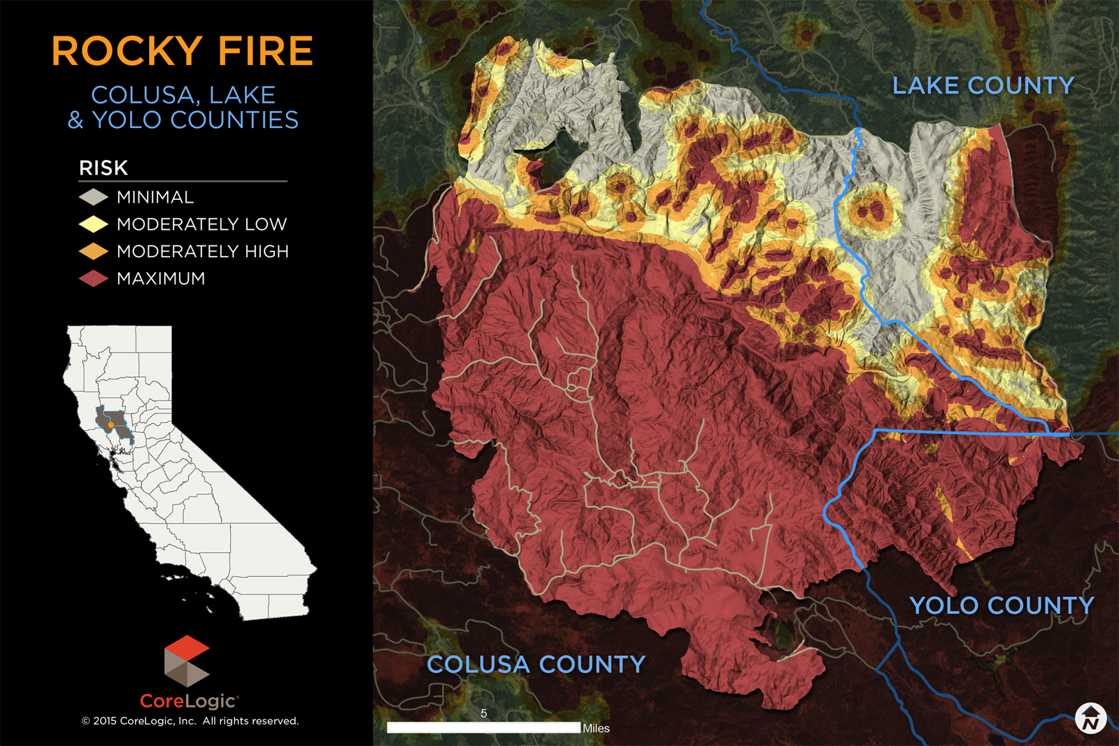
More Than 900 Homes at Risk from California Rocky Wildfires
According to CoreLogic, a total of 927 homes, or 23 percent, with a total reconstruction cost of more than $221 million are at "Maximum Risk" or "Moderately High Risk" from the Rocky Wildfire occurring in the following Northern California zip codes:
â 95423
â 95457
â 95679
â 95987
Risk levels for all of the 3,949 homes in these four zip codes based on the CoreLogic Wildfire Risk Score. The score indicates the level of susceptibility to wildfire damage and includes the risk associated with the property being located in close proximity to other high-risk properties or areas. The higher the score, the greater the risk of damage. This granular level of hazard risk assessment is important since wildfire can easily expand to adjacent properties and cause significant damage even if the property is not considered high risk in its own right. For the Rocky Wildfire, the majority of homes, 2,935, or 74 percent, are at "Minimal Risk" of damage.
 "The Rocky Wildfire is a result of the drought conditions throughout the west and especially in California. These conditions have prompted experts to anticipate a wildfire of this caliber for the last several years. Although most homes- 2,935- fall within the "Minimal Risk" zone, that doesn't diminish the risk for the more than 900 homes that are at the higher end of the risk scale," said CoreLogic Sr. Hazard Scientist Tom Jeffery.
 Real Estate Listings Showcase


This website uses cookies to improve user experience. By using our website you consent in accordance with our Cookie Policy. Read More